Nantai Mountain Hiking Guide — Climb Nikko’s Sacred Volcano
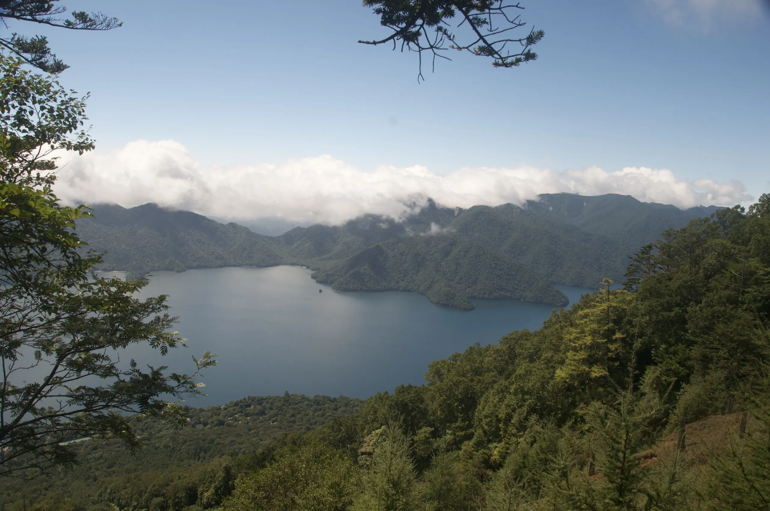
Nantai Mountain is Nikko’s most sacred peak — a 2,486 m volcanic cone above Lake Chuzenji, climbed by pilgrims for over 1,200 years. The southern trail from Futarasan Shrine is a strenuous full-day out-and-back, about 10 km round trip with 1,200 m of gain, ending in a barren reddish volcanic summit where Mt. Fuji is visible on clear days. Open May to October. Base yourself at Earth Hostel Nikko Riverhouse.
Nantaisan (男体山, Mount Nantai) is Nikko’s most iconic peak — a 2,486 metre volcanic cone that has been sacred to Japanese Shinto for over 1,200 years. The mountain rises dramatically above Lake Chuzenji, and its symmetrical silhouette dominates the skyline from almost every high point in Nikko National Park. Climbing it is a serious undertaking: a full day’s strenuous hike with over 1,200 metres of elevation gain. The reward is total. The upper section of the trail is unlike anything else in the Nikko area — a barren, reddish-purple volcanic landscape that feels like another planet. On clear days, you can see Mt. Fuji from the summit, 170 km to the south-southwest.
Trail at a Glance
| Distance | 5 km one way (10 km round trip) |
| Duration | 6.5 hours round trip |
| Difficulty | Strenuous — Grade III (full day) |
| Trailhead | Futarasan Shrine gate, Lake Chuzenji (bus stop #30) |
| Summit | 2,486 m |
| Elevation Gain | ~1,200 m (from Lake Chuzenji at 1,270 m) |
| Trail Type | Out-and-back (southern trail) |
| Season | May 1 – October (officially closed Oct–April) |
| Bus Access | Tobu/World Heritage Bus to Chuzenji Onsen, then bus to stop #30 |
| National Park | Yes — Nikko National Park |
| Entry Fee | ¥500 (Futarasan Shrine access) |
Stay at Earth Hostel Nikko Riverhouse — free morning shuttle to Nikko Station. Nantai is a long day: get an early start. No curfew at the hostel.
Why Climb Nantai?
Nantai is not a casual hike — this is a mountain that demands a full day, physical fitness, and an early start. But it is the most dramatic and memorable hike in Nikko, and one of the most rewarding day hikes in the Kanto region. It is one of more than two dozen routes covered in our Nikko hiking guide.
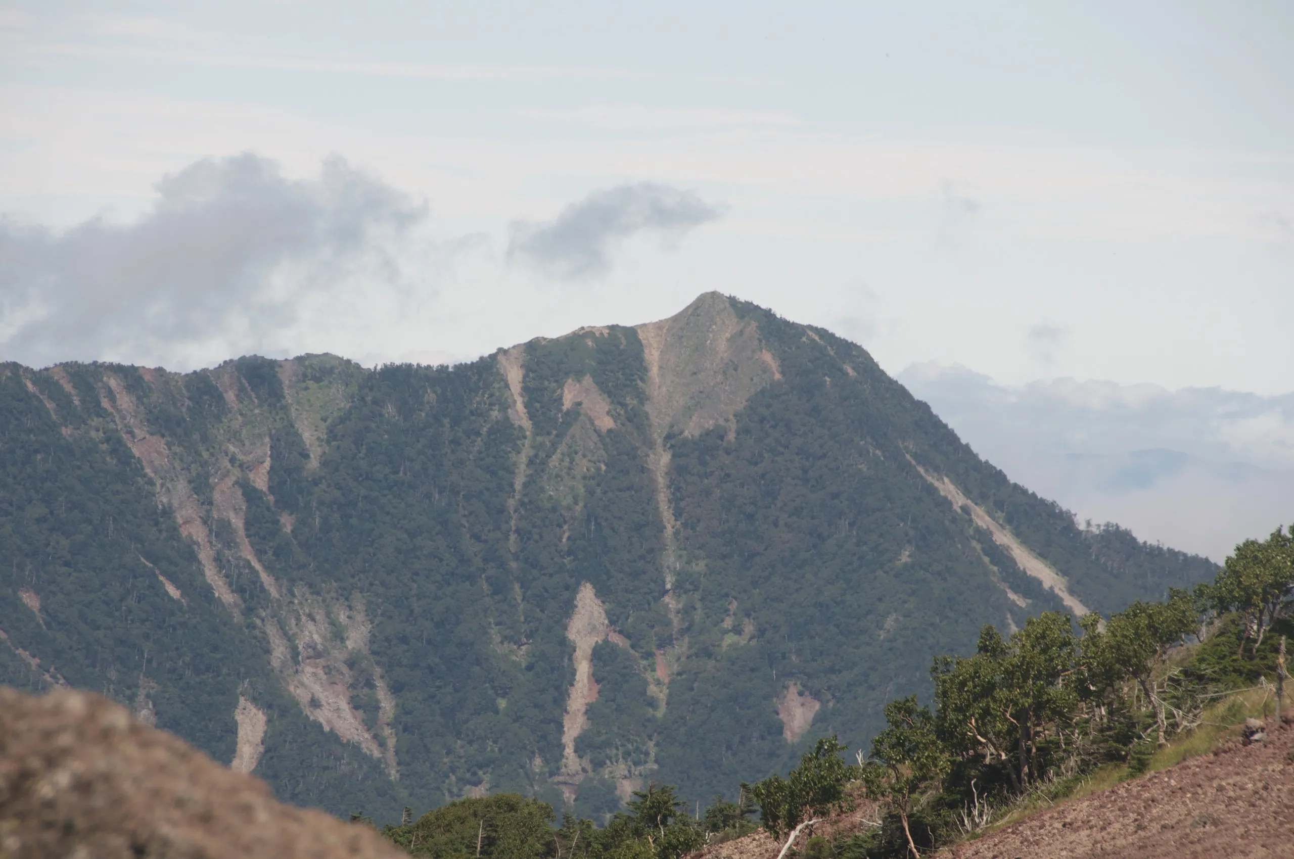
The reason is the summit terrain. For the first two-thirds of the climb, you’re in dense forest on a well-defined switchback trail. Then, at around 2,200 m, the trees disappear entirely. What appears is a landscape of loose reddish-purple volcanic rock, steep ridges, and open sky in all directions. The transition is sudden and extraordinary. There’s nothing like it in this part of Japan.
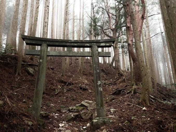
The mountain also has deep history: Shodo Shonin, the Buddhist monk who established Nikko’s temple complex, ascended Nantai Mountain in 782 CE and declared it sacred. The shrine at the summit (Okumiya) is one of the three main shrines of the UNESCO World Heritage Futarasan Shrine complex. Climbing Nantai is, in a real sense, completing a 1,200-year-old pilgrimage.
Note: For one special week every summer, you can also climb Nantai at midnight under the stars. See our Midnight Hiking Nantai event ›
Getting to the Nantai Mountain Trailhead
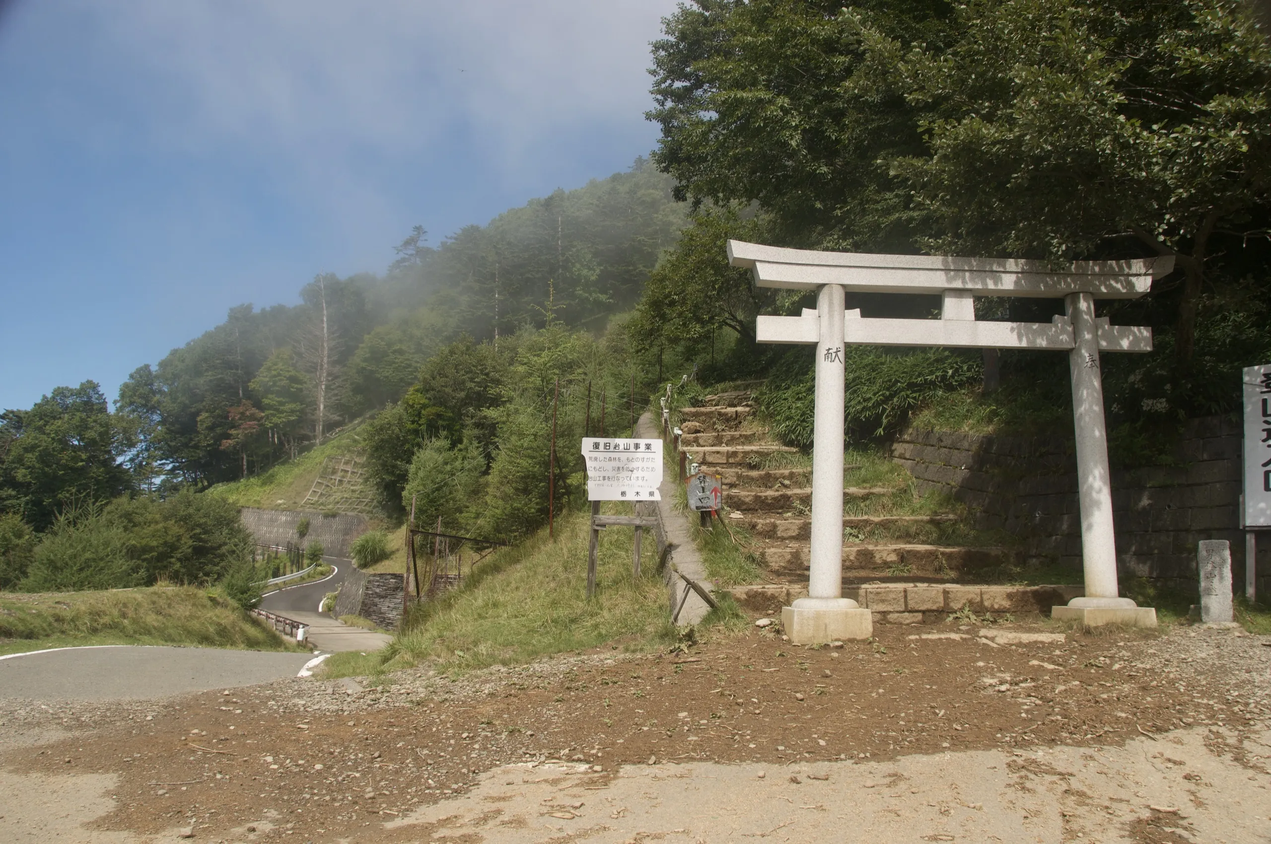
The southern trailhead (the main, accessible one) is at the Torii gate of Futarasan Shrine, at the foot of Lake Chuzenji. This is the trailhead to use unless you have a 4WD vehicle.
By bus from Nikko:
1. From Tobu Nikko or JR Nikko station, take the World Heritage Bus or Tobu Bus to Chuzenji Onsen (中禅温泉). Journey: approximately 50–60 minutes. Buy the All Nikko Pass before you go.
2. From Chuzenji Onsen, take the local bus or walk ~20 minutes to bus stop #30 at Futarasan Shrine on the lakeshore. The trailhead is directly across the road.
From Earth Hostel: The free shuttle drops guests at Nikko Station from 6–10 AM. To summit Nantai and return before dark, be at the trailhead by 8 AM at the latest — ideally earlier. Tell the hostel team your plans the night before.
Northern trailhead (two-day expedition): A northern trail approaches via Shizu Hut (号市小屋) — a quieter, wilder approach to the same sacred summit. Without a 4WD vehicle for the upper access road, it’s an extra 1 hour on foot each way from Sanbonmatsu bus stop, making this best done as a two-day overnight trip. Full guide: Nantai Mountain Northern Route ›
The Trail: Southern Route to the Summit
Allow a full day. Carry enough water and food for 7+ hours. The mountain is steep throughout; there are no flat sections after the initial approach.
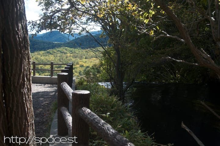
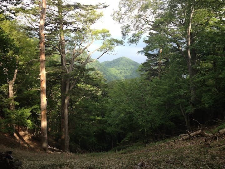
Stage 1 — Futarasan Shrine gate to tree line (0–2 km, ~1.5 hours): After entering the shrine, the trail begins on a broad service road that quickly narrows into a proper hiking path. The forest here is ancient — tall cedar and beech with dense undergrowth. The gradient is consistent and moderate, the path well-worn and easy to follow. Good views of Lake Chuzenji open through the trees as you gain height.
Stage 2 — Mid-mountain forest (2–3.5 km, ~1.5–2 hours from start): The trail steepens. The forest thins and the ground becomes rockier. Occasional wooden signs mark the route. This is the mental section of the climb — long, unrelenting uphill through trees. Take it steady. The summit is not visible from here.
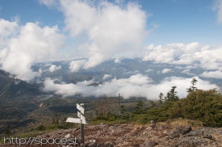
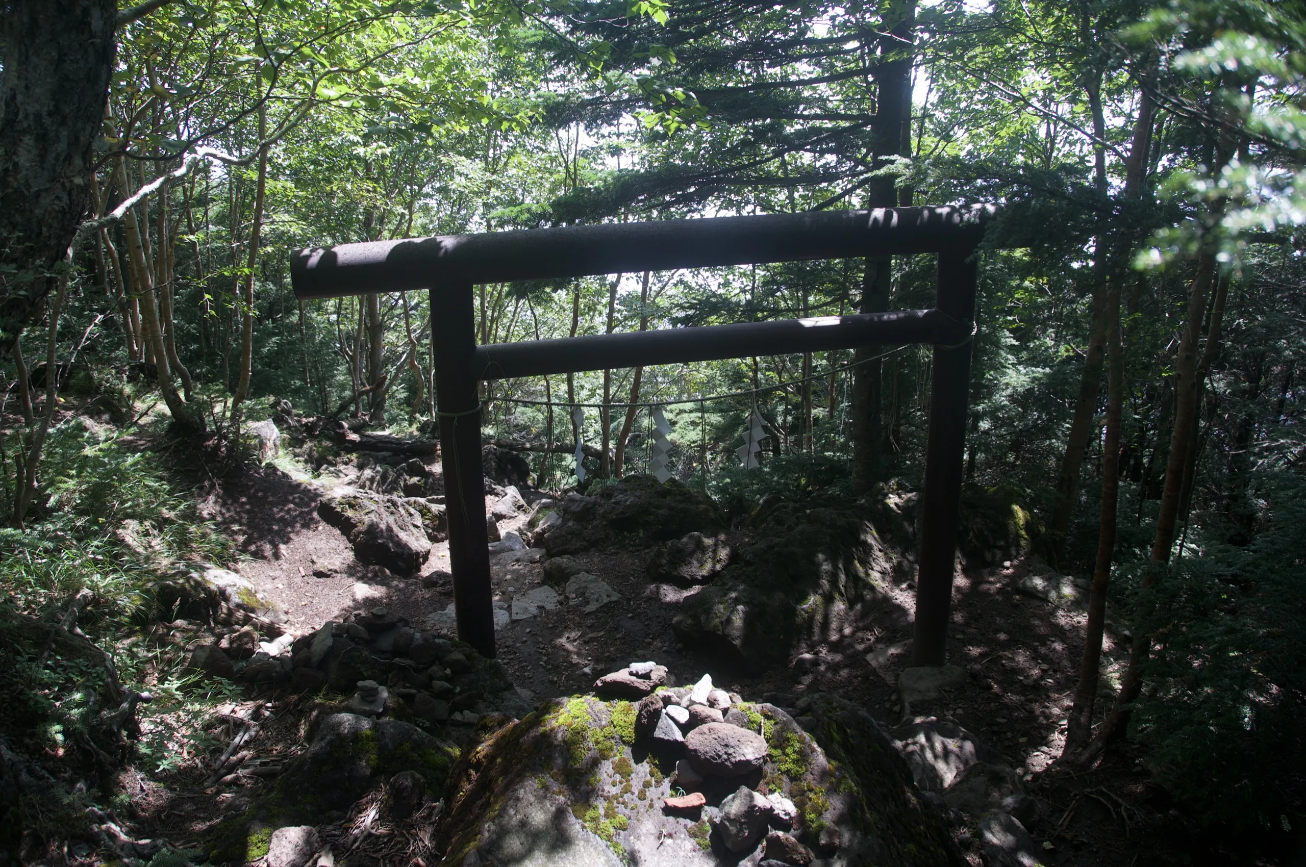
Stage 3 — Volcanic zone (3.5–5 km, ~1 hour from here): At approximately 2,200 m, the tree line breaks suddenly. The landscape shifts entirely: loose volcanic rock in shades of reddish-purple and rust, a steep rocky ridge, and nothing but sky above. The trail is marked with cairns and painted rocks. The gradient is severe — hands may be needed on some sections. The last 20% of the hike is like landing on Mars.
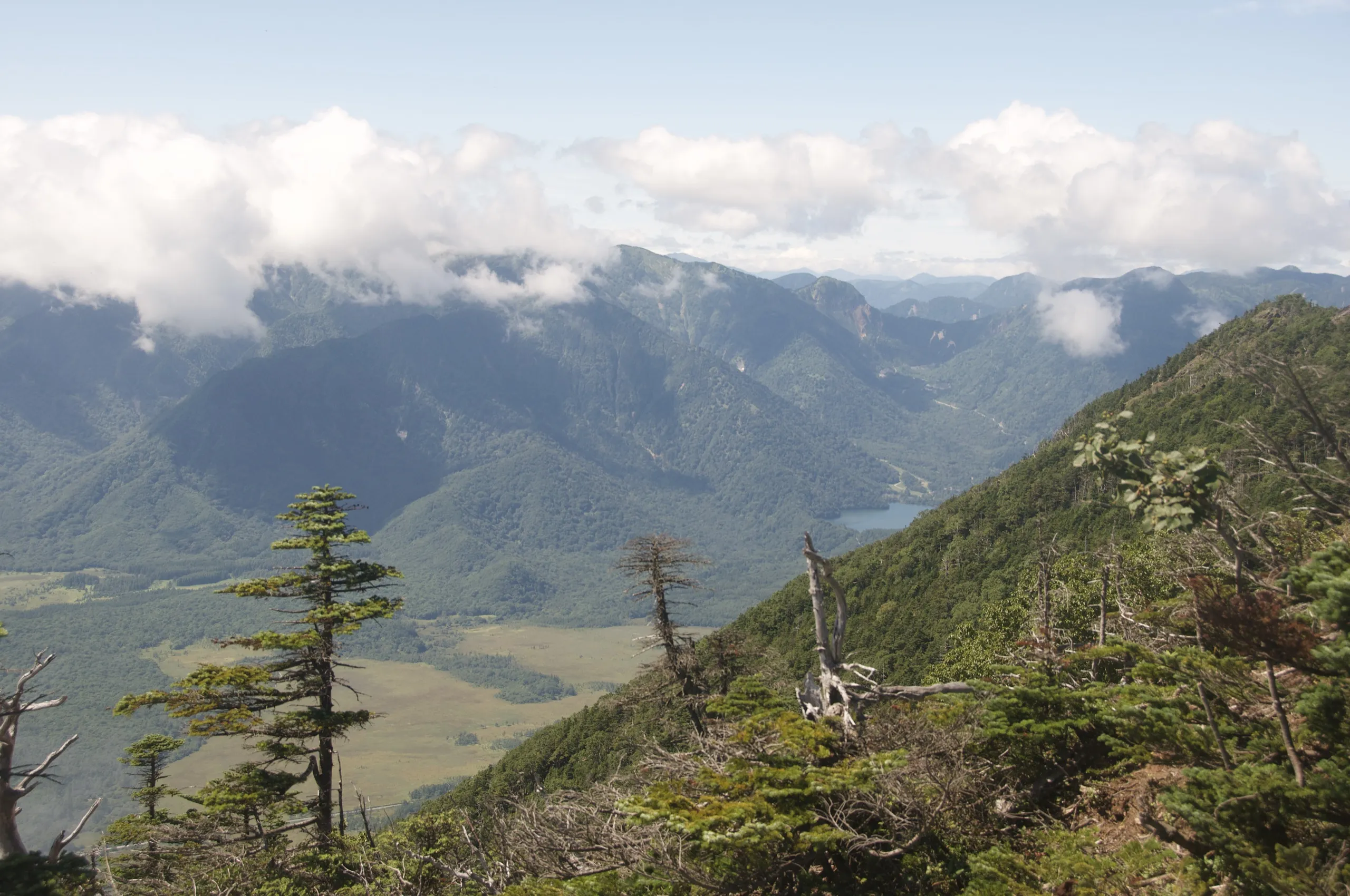
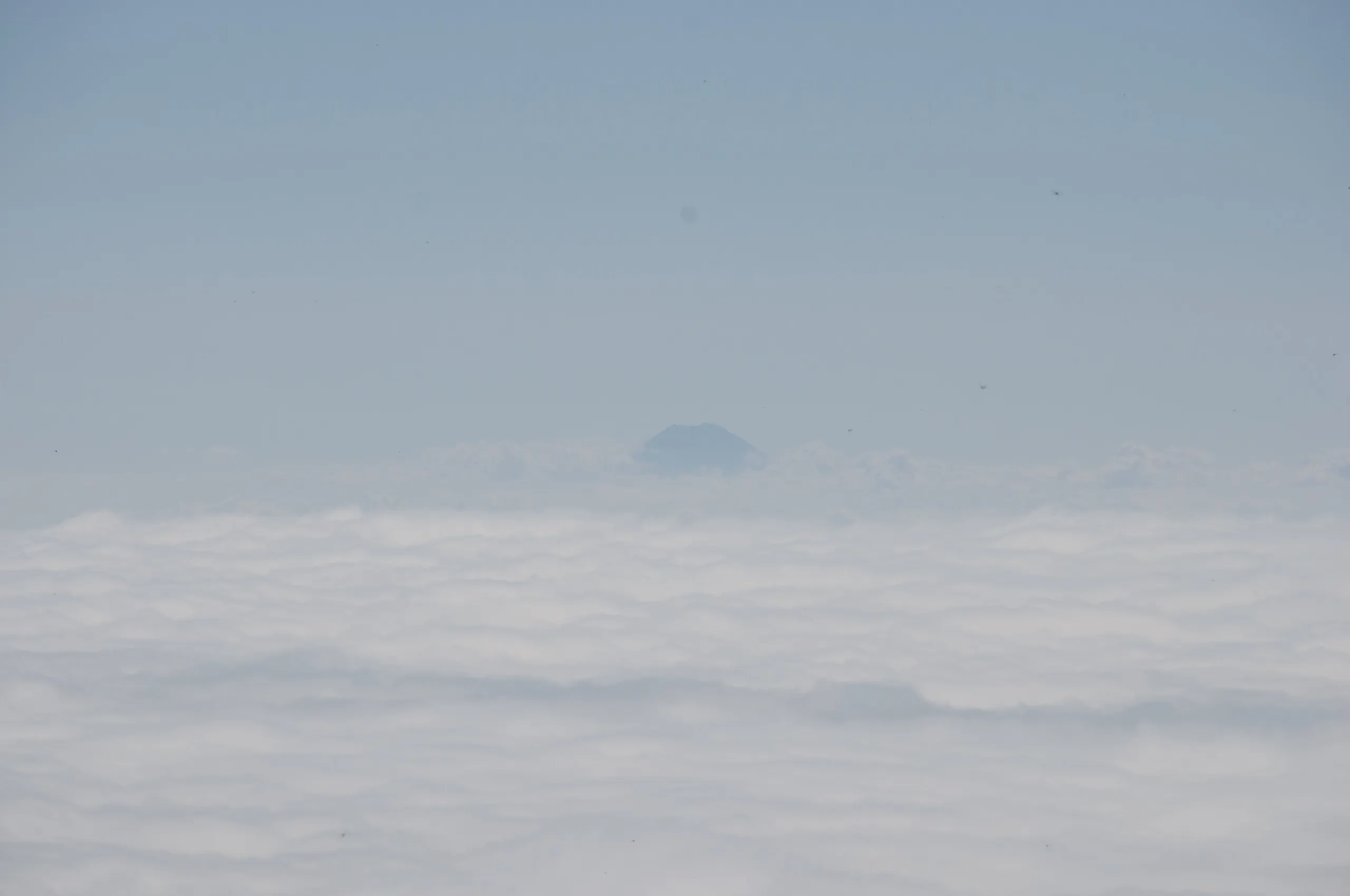
Stage 4 — Summit (2,486 m): The summit is wide, with stone markers and the Okumiya inner shrine. On a clear day, look south-southwest — Mt. Fuji is visible at a distance of 170 km. From the summit of Mt. Nantai, the initial compass bearing to Mt. Fuji is about 204°, i.e. south-southwest (SSW). The views in all directions — across Nikko National Park, toward Shirane Mountain to the north, Lake Chuzenji directly below — are the best in the region. Allow at least 20–30 minutes before descending.
Descent: Take the same southern trail down. The volcanic section is loose underfoot — trekking poles help significantly. Allow at least 2.5–3 hours for the descent.
Best Season & Trail Conditions
| Season | Conditions | Notes |
|---|---|---|
| Before May 1 | Mountain officially closed | Deep snow; dangerous conditions at altitude. Do not attempt. |
| May – June | Trail opens; cool and clear | Excellent season. Some snow possible near summit in early May. |
| July – August | Hot at low altitude; comfortable at summit | Start by 7 AM. Afternoon thunderstorms common in July — descend by 1 PM. |
| September – October | Clear skies; koyo leaves on descent | Best visibility for Mt. Fuji views. Busier on autumn weekends. |
| After October | Mountain closes | Do not attempt after the official closing date. |
What to Bring
• Proper hiking boots (not trail runners — upper section is loose rock)
• Trekking poles (strongly recommended for the descent)
• Water: minimum 2 litres per person (no water sources on the trail after the shrine gate)
• Packed lunch and snacks — nothing available on the mountain
• Layers: temperature at the summit can be 10–15°C cooler than Lake Chuzenji
• Rain jacket — summit weather changes quickly
• Headlamp (in case descent runs longer than planned)
• ¥500 cash for Futarasan Shrine entry fee
• All Nikko Pass or bus fare to Chuzenji Onsen
Frequently Asked Questions
How difficult is Nantai Mountain?
Nantai is a strenuous, full-day hike — Grade III in our grading system. It requires approximately 6.5 hours round trip with 1,200 m of elevation gain. The upper volcanic section requires careful footing on loose rock. Not suitable for beginners or very young children, but fit and experienced walkers manage it well.
When does Nantai Mountain open for hiking?
The mountain officially opens on May 1 each year when the shrine gate at the trailhead opens. It closes in October. Do not attempt the climb before the official opening date — conditions at altitude are hazardous.
How do I get to Nantai Mountain from Nikko station?
Take the World Heritage Bus or Tobu Bus to Chuzenji Onsen (50–60 min), then connect to bus stop #30 at Futarasan Shrine on Lake Chuzenji. The trailhead is directly across from the bus stop. Buy the All Nikko Pass before departing.
Is there an entry fee to climb Nantai Mountain?
Yes — approximately ¥500 at the Futarasan Shrine gate at the trailhead. Pay with cash. The fee goes to the shrine.
Can you see Mt. Fuji from Nantai Mountain?
Yes, on clear days. Mt. Fuji is visible from the summit at a distance of approximately 170 km, on a bearing of about 204° (south-southwest). Best visibility tends to be in autumn (September–October) on mornings after rain, when the air is clearest. It’s not guaranteed, but when you see it, it’s unforgettable.
Can I climb Nantai as a day trip from Tokyo?
Yes, but it’s a demanding day. Take the first Tobu Nikko Limited Express from Asakusa and be on the bus to Chuzenji by 9:30 AM. That leaves about 6.5 hours before the last bus back — tight but possible for fit hikers. We strongly recommend staying the night before at Earth Hostel and starting fresh in the morning.
Is there water on the Nantai trail?
No reliable water sources after the Futarasan Shrine gate. Carry at least 2 litres per person from the start.
Book Direct At Earth Hostel Nikko Riverhouse
Plan Your Nantai Climb from Earth Hostel
Earth Hostel is the ideal base for Nantai Mountain. Our free morning shuttle gets you to Nikko Station early enough to catch the first bus to Lake Chuzenji. We have no curfew, so even a long summit day won’t lock you out. We know the mountain well and can tell you current trail conditions, best bus timing, and whether the forecast is worth attempting the summit that day.
For hikers combining Nantai with other trails — Senjogahara the day before, Shirane or Nyoho over multiple days — we can help plan the full itinerary. See all hiking trails in Nikko ›
Last updated: April 2026. Nantai Mountain opens officially on May 1. Trail conditions, bus schedules, and entry fees may change — verify locally before departing.