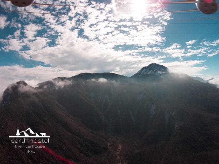
Ryuokyo Ravine Gorge

Ryuokyo means “Dragon’s Ravine” or “Dragon’s Gorge”.
For the most part, it is a gorge in these parts. There is one particular area that is certainly a ravine. The photographs below show how wicked the whole area really is.
The hike through the gorge and ravine is between Kinugawa Onsen and Kawaji Onsen. It is best to take the train to Ryuokyo station and start the northerly hike from there.
Map of Ryuokyo Station
Volcanic rock underwater volcanoes approximately 22 million years ago has been eroded by the flow of the Kinu River (Kinugawa).
Unlike the stone at Ryuzu (Dragon’s head) waterfall in another part of Nikko, there isn’t a stone that looks like a dragon. This area is named after the “home” of the dragon, after all.
The best way to visit this area from SPACE riverhouse is that we will drop you off at Shimo-goshiro station on the Tobu Nikko line and then you take the train through Shimo-Imaichi (central Nikko) to Ryuokyo station. When you want to return to the hostel in the evening, take the train to Shimo-goshiro station. Call before you board at Kawaji Yumoto so that we can meet you and you don’t have to wait.

Starting the hike from Ryuokyo station you walk the path downward into the gorge past Nijiminotaki (Waterfall). It takes about about 3 hours to hike north to Kawaji Yumoto station. Most of it is flat with a slight grade until you get closer to the Kawaji Onsen area.
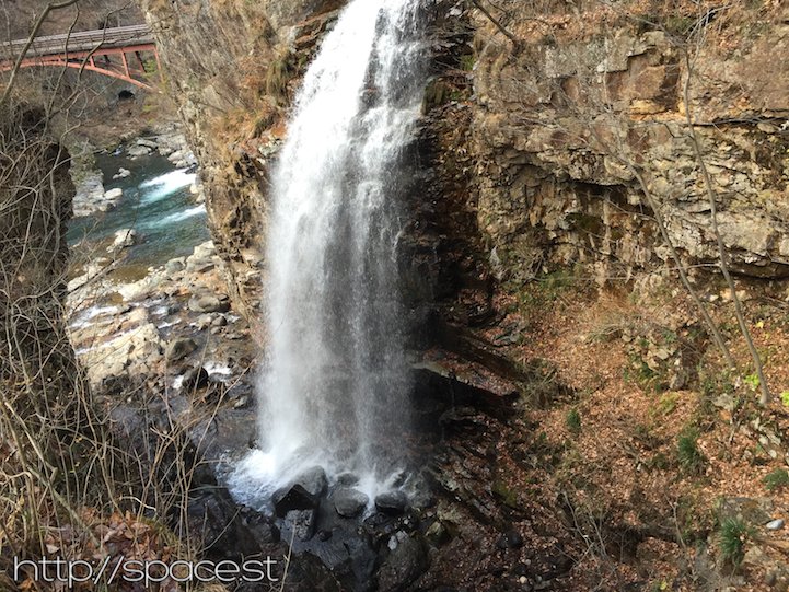 Nijiminotaki waterfall
The trail starts here, and as you can see from the photograph below, the trail really is at the beginning as all the great views are north of here.

From here you’ll cross your first bridge over Kinugawa. (King’s River)
 kinugawa-from-bridge-ryuokyo.jpg
From the bridge you will get a great view of Nijiminotaki (waterfall).

The trail over the bridge will take you along the left side of the river as seen in the photograph below.

As you approach the true ravine of the gorge, you see what 22 million years of water flow can do to stone and how the average water level and peak level color the faces of stones of the ravine.

The ravine is truly spectacular, there are stones that extend over the river!

The pools of deep water are magnificent.

You’ll soon arrive at the most photogenic vantage point looking both downstream and upstream.


Map of Kawaji Yumoto Station
[googlemaps https://www.google.com/maps/embed?pb=!1m14!1m8!1m3!1d3192.23088425394!2d139.71858699999999!3d36.860892!3m2!1i1024!2i768!4f13.1!3m3!1m2!1s0x601f98ee28828edf%3A0xf8864cd740630327!2sRyuokyo+Station!5e0!3m2!1sen!2sjp!4v1421990652899″ width=”400″ height=”300″ frameborder=”0″ style=”border:0″>